


As many as 30 million people were in the path of the spring’s biggest storm yet — a monster stretching Wednesday from the Gulf of Mexico to Canada and east to the Atlantic Ocean, which was already dropping giant hail on parts of the Midwest and threatened the greatest likelihood of tornadoes anywhere in the country.
Brief tornado warnings dotted Missouri and Indiana as the system began coalescing into what meteorologists call “supercells” — intense thunderstorms buoyed by cyclone-like rising winds. They’re they least common but most dangerous kind of thunderstorm, the National Weather Service said.
“There’ll be a lot of supercells,” said Ari Sarsalari, a meteorologist for The Weather Channel. “That’s why we have the tornado threats. That’s why we have the hail threats.”
The danger zone for twisters Wednesday included parts of Kentucky, Texas and Oklahoma in addition to Missouri and Indiana. Thursday, the highest danger is expected to shift east, toward Chicago, St. Louis, Missouri, and the Great Lakes. Franklin County in Ohio canceled a scheduled test of its tornado siren system Wednesday, because it might be needed for the real thing, NBC station WCMH of Columbus reported.
“This has the potential to be the most widespread severe weather event so far this spring,” said Jon Erdman, another meteorologist for The Weather Channel.
Thunderstorms began rolling through parts of Indiana, Kentucky and Missouri on Wednesday morning, followed by hail and damaging wind in the afternoon.
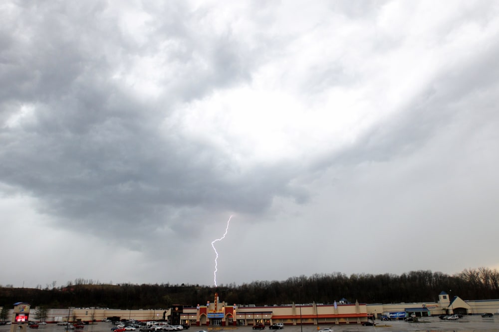
Intense lightning struck Wednesday in Nelson County, Kentucky, ahead of winds that put parts of the state and southern Indiana under tornado watches through Thursday morning, the National Weather Service said. Grapefruit-size hail fell around the eastern Missouri town of Sullivan about 2:30 p.m. (3:30 p.m. ET), smashing car windshields and damaging some homes. Roofs were blown off buildings and hoods were torn off vehicles in nearby Potosi, Missouri, as a storm moved through with near-tornado winds Wednesday afternoon. The two days of forecast severe weather followed several outbreaks Tuesday that saw flooding in St. Louis and two tornadoes in Kansas, according to the National Weather Service. This article originally appeared on NBCNews.com.
Alexander Smith Recommended


![]()