You’ve likely heard already that tomorrow (or today, depending on which side of sleep you’re on) is this year’s super moon. The super moon is the nearest full moon. This year the moon is officially full 25 minutes before it’s at its perigee, its closest point to Earth, so like last year expectations are high for something spectacular. But unlike last year, I want to see if I can do more than find the right camera settings for a nice super moon photo.
What I know about the moon this year is that it’s bright. If you want to see details on the moon instead of a glowing white circle, you can’t let too much light into your camera. But if you wait until it’s too dark out, all you’ll get is the moon and everything else will be black. So what you want to shoot for is the “blue hour,” which is that time when the sun is down but there’s still some light in the sky.
You also want the moon as low as possible on the horizon. Not only will this give you the buildings or mountains or trees you need to make the photo interesting, but you can take advantage of an optical illusion that makes the moon seem even bigger.
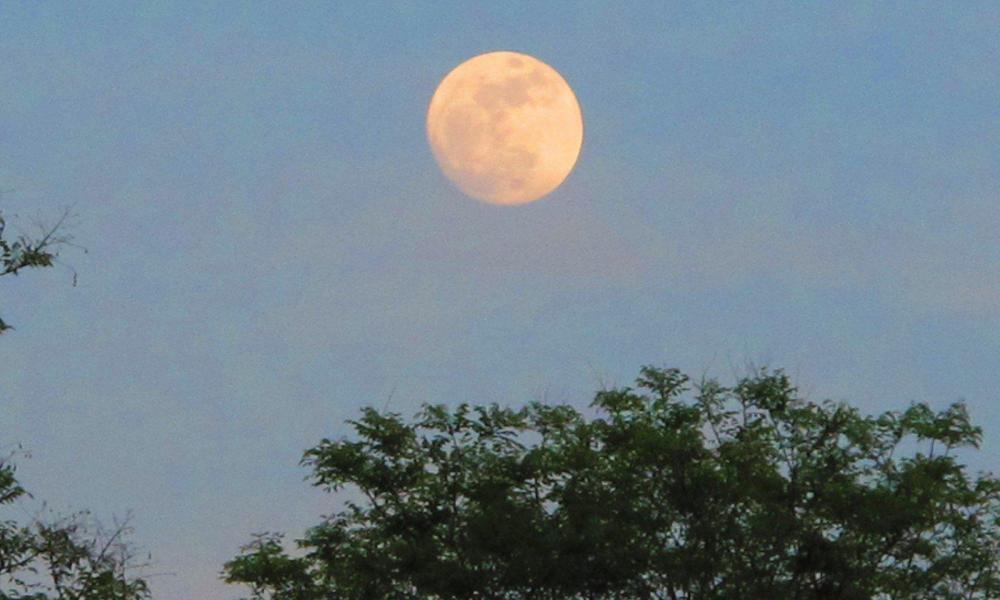
So we need to know what time is going to be right and where the moon is going to be at that time. Thanks to my colleague Andy Dallos we have a bit of a cheat for knowing the time. He took the photo below at around 7:45 p.m. ET Friday.
That looks like a good amount of ambient light and it’s not too high in the sky. But if you really want to plan your shot, or at least consider your possibilities, we have to know where in the sky it’s going to be at that time.
It’s about to get nerdy up in this muh-fuh…
Astronomers call the moon’s path across the sky its azimuth. Actually, I guess anything’s path across the sky is called an azimuth, and really, the azimuth only describes the horizontal arc it makes. To get the actual path you have to add in the altitude. Luckily, there are online calculators to figure this out for us. I’ve been using this one from the Astronomical Applications Department of the U.S. Naval Observatory. Plug in your location and the date and it gives you the incremental path of the sun or moon.
For the time range we’re looking at, the calculator gives us this:
19:30 6.3 121.1 1.0019:40 7.9 122.8 1.0019:50 9.3 124.6 1.00
The first column is the time. The next column is the altitude from the horizon (90 would be straight up). Next is the azimuth, which is measured in degrees east of north, and last is the fraction of the moon illuminated at that time. 1.00 means 100% full.
Incidentally, the sun path at this point looks like this:
19:40 -8.2 300.3
That negative number for the altitude means it’s below the horizon – it has set.
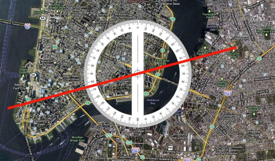
There’s probably a smart way to know how to figure the azimuth in the real world, but I do it with Photoshop. I took a 120° angle with one side lined up vertical (north) and put it on top of a Google map of my area. Andy and I had been talking earlier about getting the moon when it’s behind the Empire State Building, so I moved the angle such that my 120° line passes across 34th Street where the Empire State Building is.
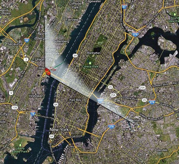
It looks like standing on one of those overlook streets in Weehawken, NJ would do the trick.
But look at what else. The line doesn’t just pass across 34th Street, it traces it! An astronomical event that aligns with the Manhattan street grid? IT’S MOONHATTANHENGE!!!
Sure enough, the Manhattanhenge Wikipedia entry explains that the midtown streets “are laid out in a grid offset 29.0 degrees from true east–west.” We’re measuring from true north, so add another 90 degrees: 90+29=119°! Ok, I realize Manhattanhenge is about the sun setting and we’re talking about the moon rising, but c’mon. For the sake of finishing the math, we could add 180° to our street angle to find it in the westerly direction: 119+180=299°. According to the calculator, the moon set a few minutes ago pretty far from 299°: 04:00 1.2 247.7 0.99 I know from experience that some of you reading this know a lot more about it than I, so maybe you can help me with a question I haven’t been able to work out. From my kitchen in North Brooklyn, I can see Lower Manhattan. Periodically I see the moon set behind the skyline and I always think it’d be great to catch the moon rising at that point – if it ever does. So with my Photoshop trick I can figure out the rough azimuth. Say, 255°. And a relatively low altitude would be fine, like…. 8? But how do I work backward from those numbers to get the date on which those conditions will be met? I need some kind of reverse calculator. FOLLOW-UP: Well, I got nothing this weekend. New York City was totally overcast. Better luck next time. I tried again tonight, but the moonrise was almost an hour and a half later (never would have guesed that) and it was way too dark for the kind of contextual shot I was hoping for. Some things I’ve learned since yesterday: Thanks very much to everyone who offered comments and insights. Recommended